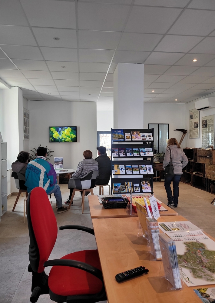
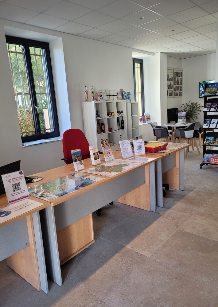
Extérieur
OTIPF
Tourism institutions

Tourist Office of Tanneron- l'oustaou dou païs

The Tourist Information Office - l'Oustaou dou païs - is open from mid-January to early March, during school vacations and in July and August.
Our team can advise you on all the Pays de Fayence hilltop villages and the Lac de Saint Cassien.

Description

Reception services
store selling local produce from Tanneron and Pays de Fayence
Event registration
Public Wifi
Relaxation area - educational and promotional videos on mimosa and Pays de Fayence.

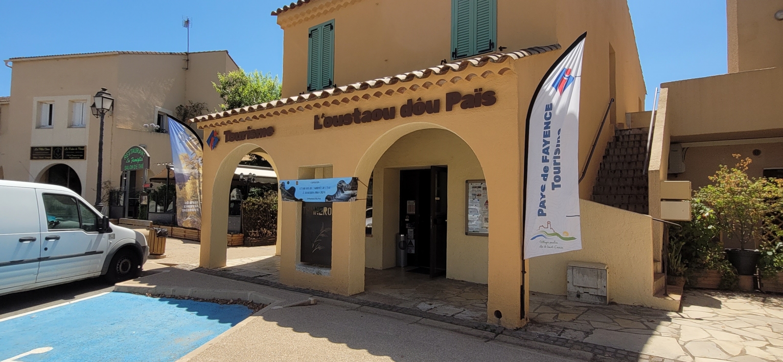
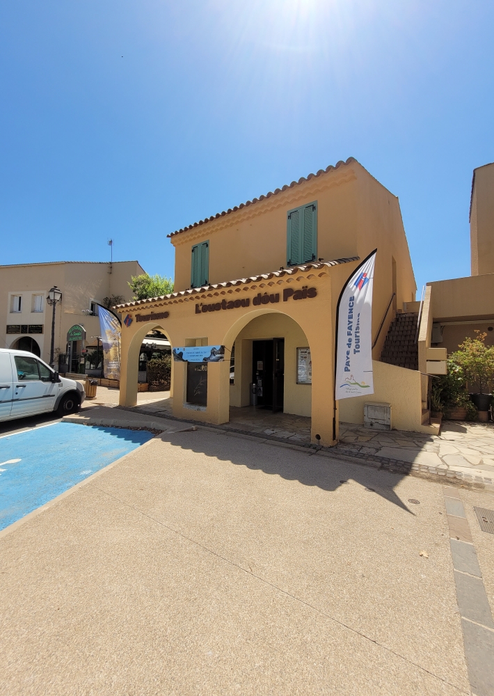
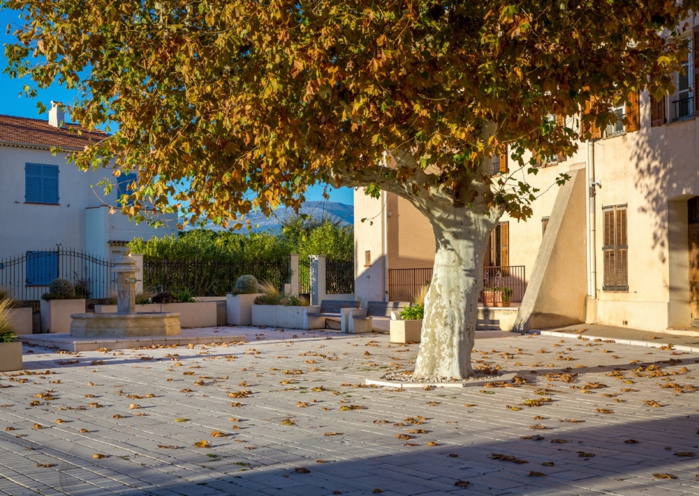
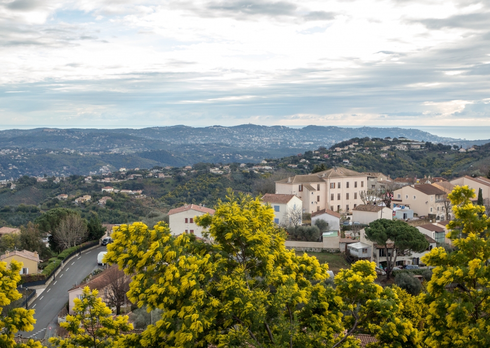
The Tanneron Tourist Information Office is located in the Oustaou dòu païs in the heart of the village, on the town hall square.
This house (the former post office) is a place to discover the region's agricultural and mimosa heritage, a tourist information office and a local produce store.

Free admission.
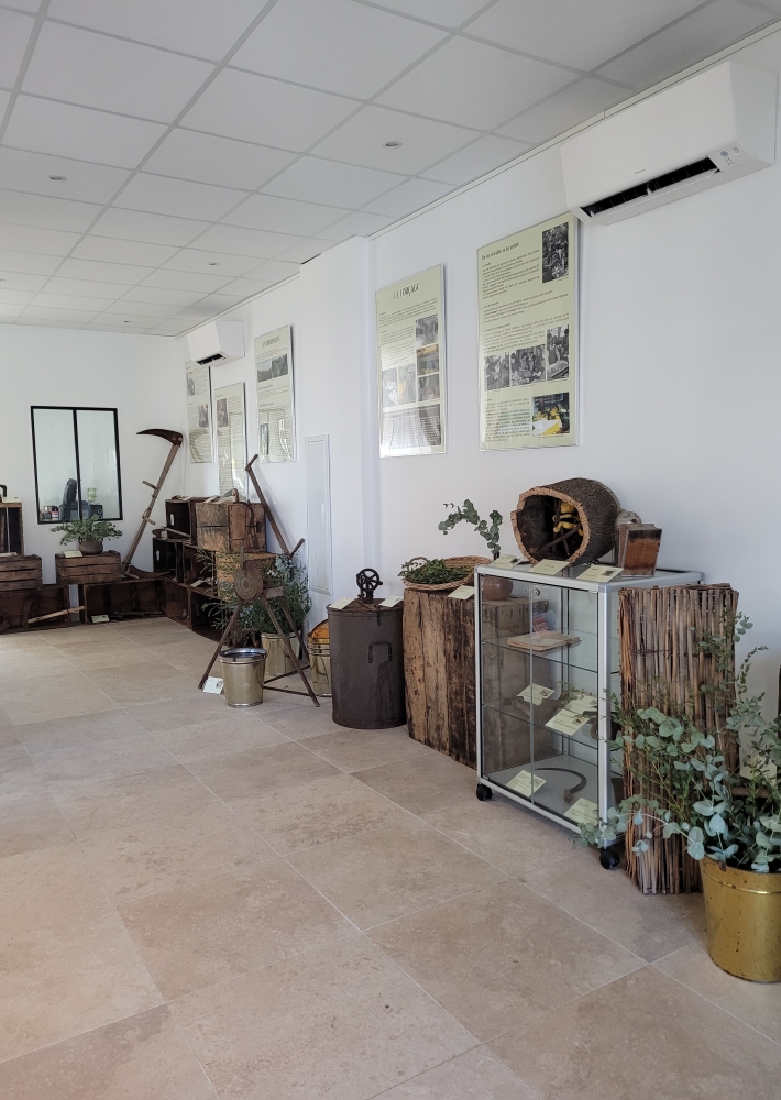
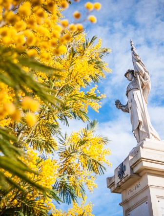
You'll find an educational exhibition on the mimosa in Tanneron and old tools recounting agricultural activity in the Massif de Tanneron.

New in 2024:
Exhibition on 60 years of water in Tanneron.
May to mid-December.
Discover the local heritage and how running and irrigation water was brought to the village and its hamlets.

Contact us, follow us
www.paysdefayence.com
contact@paysdefayence.com
Facebook :
Pays de Fayence Tourism
Going out in Pays de Fayence Intercommunal tourist office
Lac de St Cassien-Pays de Fayence Tourisme
Instagram #paysdefayence

Further information

  • flag-ENEnglish
  • flag-FRFrench
  • Services : 
    Wi-fi
    Reception service available
  • Equipments : 
    Car park
  • Environments : 
    Village centre
    In the country
Estérel Côte d'Azur depending on your mood
Weather
Sea side
Today
-- °C Wind : -- km/h
Tomorrow
-- °C Wind : -- km/h
After tomorrow
-- °C Wind : -- km/h
Hinterland
Today
-- °C Wind : -- km/h
Tomorrow
-- °C Wind : -- km/h
After tomorrow
-- °C Wind : -- km/h
Water temperature
Fréjus -- °C
Saint-Raphaël -- °C
Les Issambres -- °C
+
-

Clic on areas to zoom in

Clear map
Dark map
Map zone 1
Map zone 2
Map zone 3
Map zone 4
Map zone 5
Map zone 7
Map zone 6
Map zone 8
pays de fayence - nord

Fayence area

The Pays de Fayence (Fayence district) has many great provencal villages. All of them have a particularity such as the view from Mons or the artistic streets of Tourrettes. Do no forget to stop in Seillans that has the label of "Most beautiful village in France"

Go back to map
pays de fayence - sud

Fayence area

North of the A8 motorway, you will find the Pays de Fayence. Saint-Cassien lake, a real oasis of freshness in the Var, awaits you! Take a break at the Lake House before visiting the villages of Bagnols-en-Forêt, St-Paul-en-Forêt or Tanneron.

Go back to map
roquebrune sur argens - la bouverie

Roquebrune-sur-Argens

The city of Roquebrune-sur-Argens is the most westerly of the destination. It includes three districts: La Bouverie, at the foot of Gorges du Blavet; The village, overlooked by its magnificent rock, and Les Issambres, with its nautical activities by the sea.

Go back to map
les adrets de l'esterel

Les Adrets de l'Estérel

Les Adrets de l'Estérel is a small town located at the extreme southeastern Var. Bordering the Maritimes Alpes, it is composed of large green forests. The town overlooks the bay of Cannes and has an exceptional view on the Lérins Islands and the Corniche de l'Estérel.

Go back to map
village de puget sur argens

Puget sur Argens

Puget sur Argens is a small village located in the middle of many wineries. Its commercial area, near the village, includes many shopping center. North of the village, the Bois du Defens give rise to several walks.

Go back to map
roquebrune-sur-argens - les issambres

Les Issambres

Welcome to Les Issambres, the district of Roquebrune-sur-Argens located on the coast. True paradise with its 8 km of beaches and creeks, this family seaside resort, already frequented at the time by the Romans, is located between the Gulf of Saint-Tropez and Fréjus-Saint Raphaël.

Go back to map
ville de frejus - saint-aygulf

Fréjus

Frejus, located halfway between Cannes and Saint-Tropez, is at the heart of the Côte d'Azur. Based on a sandstone buttress of the Esterel massif, the town dominates the valleys of Argens and Reyran. Frejus has the appearance of a small Provencal town whose new districts extend to the sea.

Go back to map
saint-raphael - massif de l'esterel

Saint-Raphaël

65km from Nice Côte d'Azur International Airport, Saint-Raphaël is located between Cannes and Saint-Tropez. This seaside resort on the Mediterranean coast is at the bottom of the great Esterel mountains. Saint Raphael, whose city center is by the sea, is divided into different neighborhoods that have all their characteristics and their personalities.

Go back to map
Fayence areaFayence areaRoquebrune-sur-ArgensLes Adrets de l'EstérelPuget sur ArgensLes IssambresFréjusSaint-Raphaël
Webcams
Subscribe to our newsletter