Randonnée - Le tour du Cap Roux
Estérel Côte d'Azur
Pedestrian sports, Hiking itinerary

Hiking around Cap Roux

A sensational 360° panoramic view of the French Riviera from the top of Cap Roux.

Description

> ACCESS
Drive along the seafront towards Agay. At the Agay roundabout, follow the signs for "Massif de l'Estérel". Continue for 1 km and turn right onto the small road signposted "Massif de l'Estérel". Then follow the signs for "Pic de l'Ours" for 6 km and park at the Sainte-Baume car park.

> STARTING POINT
GPS coordinates: 43.459047, 6.896984
Saint-Baume car park

> ITINERARY
Climb the staircase leading to the chapel in the rock. Follow the path to the fountain (drinkable spring water). Take the footpath on the right for 50 m, then take the path that climbs up on the left.

About 600 m further on, turn sharp left.
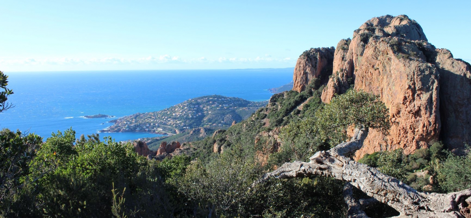
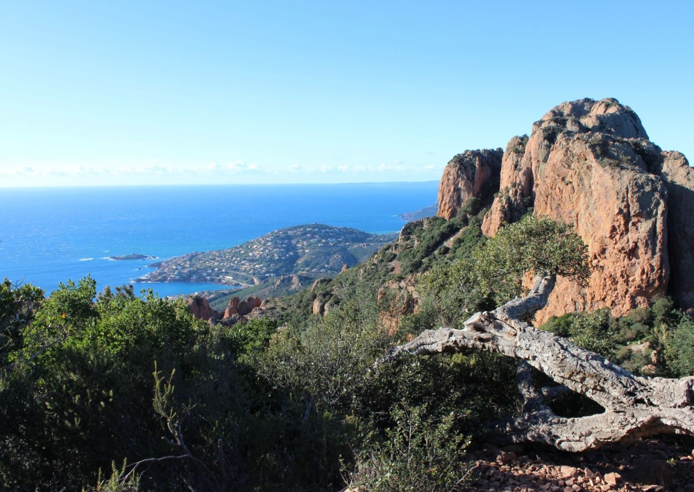
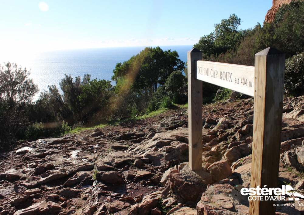
Continue for around 800 m and, when you reach the Col, turn left to climb towards the red rocks of Cap Roux.
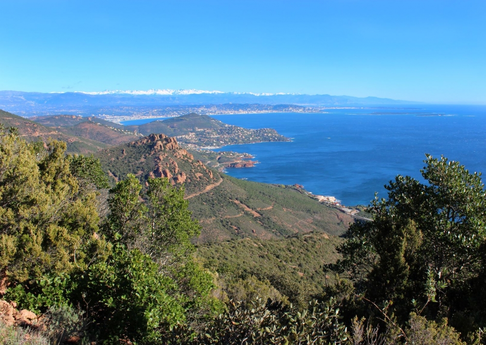
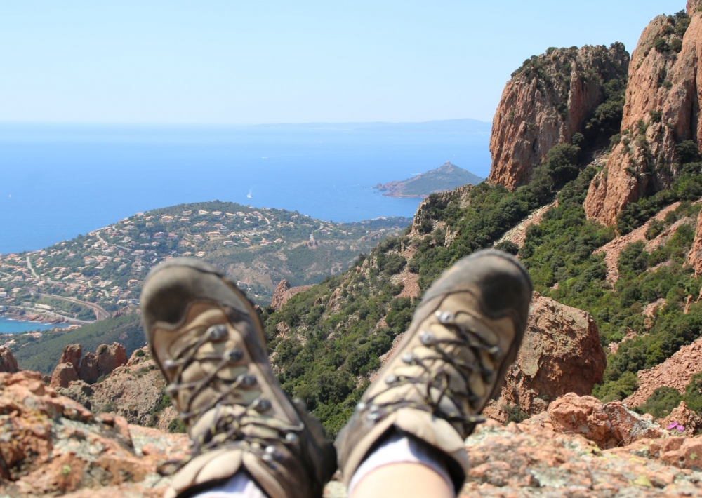
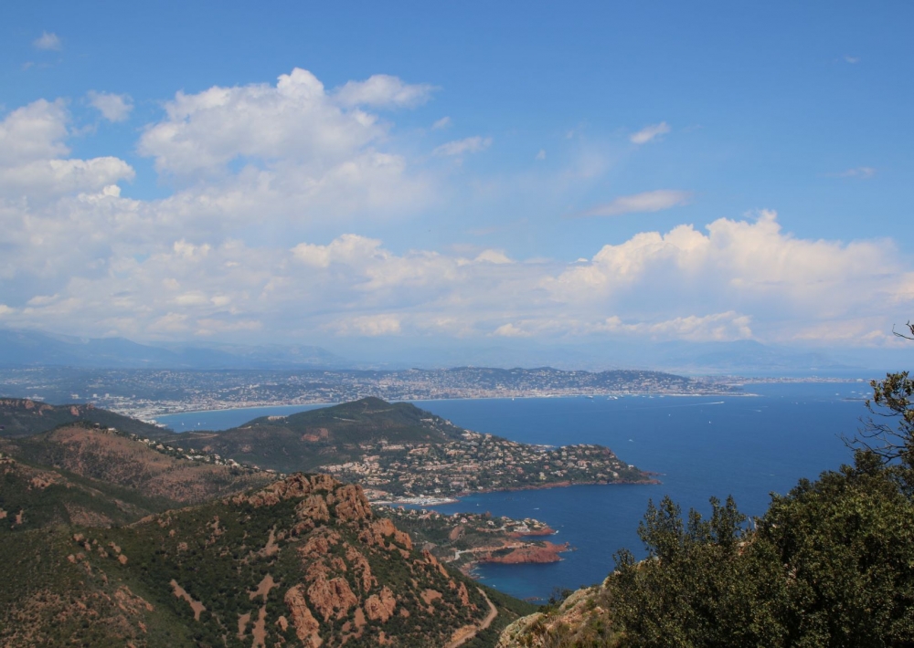
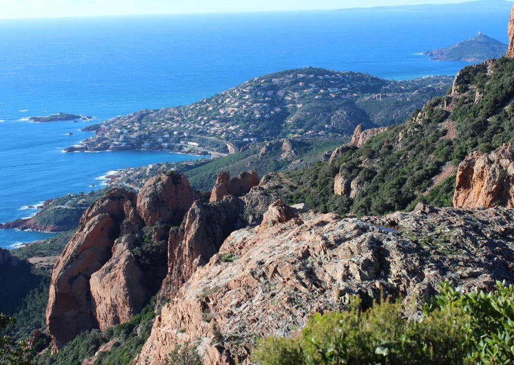
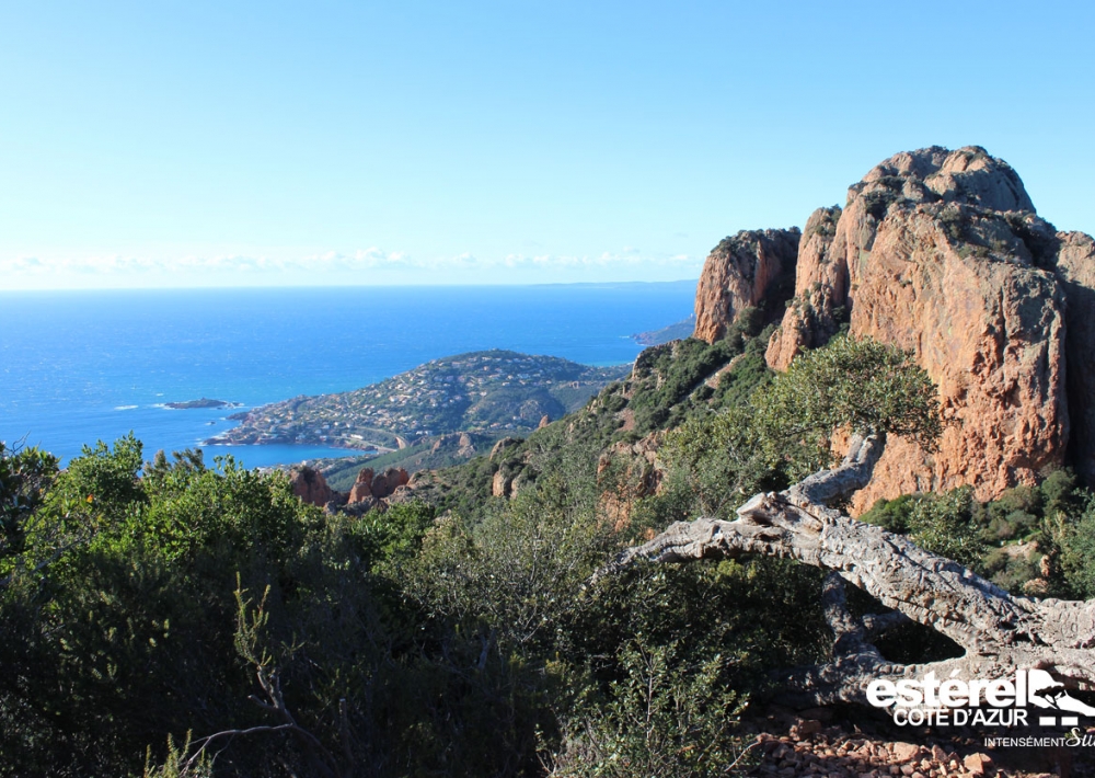
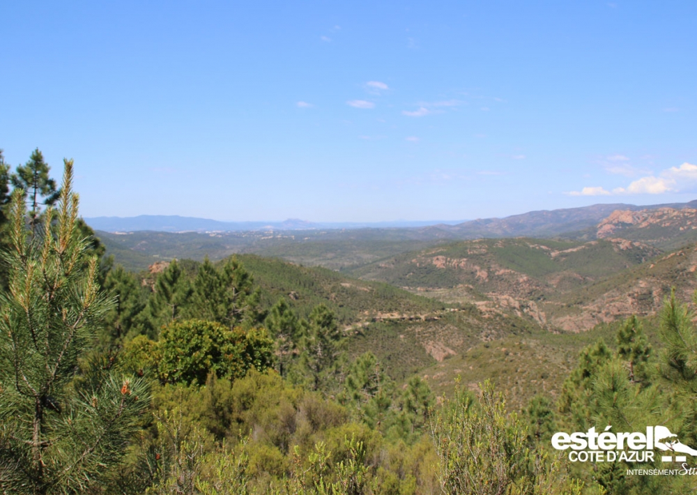
Admire exceptional views of the jagged coastline.

The path runs along this ledge and then leads to a new intersection.
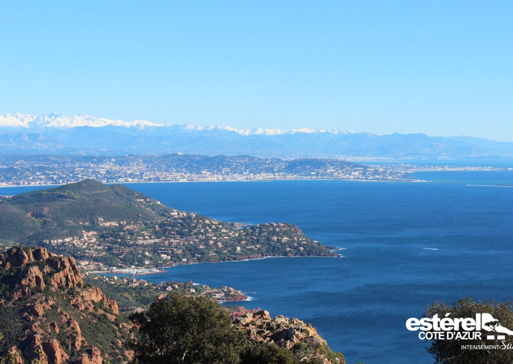
On the left, the dead-end path takes you 100 m to the summit of Cap Roux and its orientation table (453 m altitude with views from Cannes to Cap Camarat).

Go back down the same path and turn left to continue the walk towards Cannes. Leave the sea side of Cap Roux and head gently down towards the Massif (do not take the paths leading off to the right) to find the fountain.

> VARIOUS: Just before returning to the fountain, a path climbs up on your left, after a few small steps, to the Sainte-Baume grotto where the hermit Saint Honoratus lived. (45-minute round trip).
Variant via the Col du Saint-Pilon (5 km, 470 ascent - yellow markings)
Caution! An aerial section on the way up to the cave and a rocky scree section on the last part of the way back.

Further information

  • flag-FRFrench
  • Type of customers : 
    Level bue - Medium
  • On-site activities : 
    Pedestrian sports
    Hiking itinerary
  • Environments : 
    Panoramic view
    Sea view
    Mountain location
Estérel Côte d'Azur depending on your mood
Weather
Sea side
Today
-- °C Wind : -- km/h
Tomorrow
-- °C Wind : -- km/h
After tomorrow
-- °C Wind : -- km/h
Hinterland
Today
-- °C Wind : -- km/h
Tomorrow
-- °C Wind : -- km/h
After tomorrow
-- °C Wind : -- km/h
Water temperature
Fréjus -- °C
Saint-Raphaël -- °C
Les Issambres -- °C
+
-

Clic on areas to zoom in

Clear map
Dark map
Map zone 1
Map zone 2
Map zone 3
Map zone 4
Map zone 5
Map zone 7
Map zone 6
Map zone 8
pays de fayence - nord

Fayence area

The Pays de Fayence (Fayence district) has many great provencal villages. All of them have a particularity such as the view from Mons or the artistic streets of Tourrettes. Do no forget to stop in Seillans that has the label of "Most beautiful village in France"

Go back to map
pays de fayence - sud

Fayence area

North of the A8 motorway, you will find the Pays de Fayence. Saint-Cassien lake, a real oasis of freshness in the Var, awaits you! Take a break at the Lake House before visiting the villages of Bagnols-en-Forêt, St-Paul-en-Forêt or Tanneron.

Go back to map
roquebrune sur argens - la bouverie

Roquebrune-sur-Argens

The city of Roquebrune-sur-Argens is the most westerly of the destination. It includes three districts: La Bouverie, at the foot of Gorges du Blavet; The village, overlooked by its magnificent rock, and Les Issambres, with its nautical activities by the sea.

Go back to map
les adrets de l'esterel

Les Adrets de l'Estérel

Les Adrets de l'Estérel is a small town located at the extreme southeastern Var. Bordering the Maritimes Alpes, it is composed of large green forests. The town overlooks the bay of Cannes and has an exceptional view on the Lérins Islands and the Corniche de l'Estérel.

Go back to map
village de puget sur argens

Puget sur Argens

Puget sur Argens is a small village located in the middle of many wineries. Its commercial area, near the village, includes many shopping center. North of the village, the Bois du Defens give rise to several walks.

Go back to map
roquebrune-sur-argens - les issambres

Les Issambres

Welcome to Les Issambres, the district of Roquebrune-sur-Argens located on the coast. True paradise with its 8 km of beaches and creeks, this family seaside resort, already frequented at the time by the Romans, is located between the Gulf of Saint-Tropez and Fréjus-Saint Raphaël.

Go back to map
ville de frejus - saint-aygulf

Fréjus

Frejus, located halfway between Cannes and Saint-Tropez, is at the heart of the Côte d'Azur. Based on a sandstone buttress of the Esterel massif, the town dominates the valleys of Argens and Reyran. Frejus has the appearance of a small Provencal town whose new districts extend to the sea.

Go back to map
saint-raphael - massif de l'esterel

Saint-Raphaël

65km from Nice Côte d'Azur International Airport, Saint-Raphaël is located between Cannes and Saint-Tropez. This seaside resort on the Mediterranean coast is at the bottom of the great Esterel mountains. Saint Raphael, whose city center is by the sea, is divided into different neighborhoods that have all their characteristics and their personalities.

Go back to map
Fayence areaFayence areaRoquebrune-sur-ArgensLes Adrets de l'EstérelPuget sur ArgensLes IssambresFréjusSaint-Raphaël
Webcams
Subscribe to our newsletter